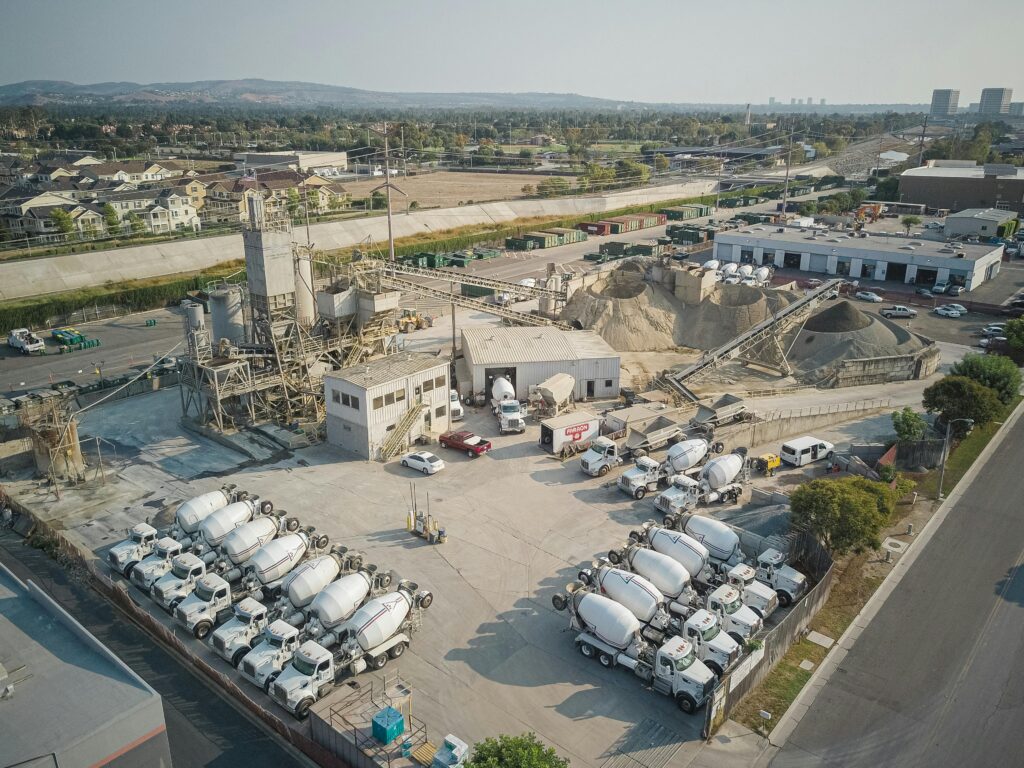
Track your construction project from start to finish with consistent, professional drone documentation. We provide repeatable aerial progress reports that keep builders, investors, and lenders informed—without constant site visits.
Repeatable visuals for true progress comparison
Delivered on your schedule
Commercially insured documentation services
FAA Part 107 licensed drone operations.
This service helps:
Site-wide aerial overviews
Foundation, framing & roofing progress
Material staging & equipment placement
Access roads & site layout
Timeline comparisons between flights
Optional ground-level photos & video
Construction projects move fast, and without consistent documentation it’s easy to lose visibility. Drone progress monitoring provides a complete overhead view of the site—helping verify work completion, track timelines, and maintain accountability throughout the build.
This creates a permanent visual record you can rely on.
Eye In The Sky Services works with various construction industries & provides services to the following construction fields
Real drone flights documenting five weeks of construction progress. Each flight captures verified milestones, site conditions, and visual proof of work completed.
Shoots were done off property because the client did not want workers distracted on the property so I went casually dressed. The vast majority of on-site flight operations – hard hats, Safety Vests, Boots, and identification will be worn at all times.
At Eye In The Sky Services, our construction monitoring begins from the ground up—literally. In Week 1 of our aerial monitoring for the Dutch Bros and Wendy’s construction site, our focus was on capturing the early stages of development.
During this first flight, we documented:
The full plot of land from multiple angles to establish a visual baseline.
Ground clearing and grading work, showing the preparation phase before vertical construction begins.
Foundation work, including trenching, plumbing layout, and concrete forms for both Dutch Bros and Wendy’s.
Key equipment and staging areas to help track asset locations over time.
DELIVERABLES INCLUDED
High-resolution aerial photos (top-down and oblique)
4K video flyovers for project managers and stakeholders
Side-by-side comparison layout for future time-lapse monitoring
These visuals serve as a documented starting point and will be critical for comparing week-to-week progress throughout the project timeline.
In Week 2, Eye In The Sky Services returned to the Dutch Bros and Wendy’s construction site to monitor and document the progress made since our initial flight.
Progress Monitoring and Comparison
This week’s aerial mission focused on capturing the visual changes to the site, allowing stakeholders to assess momentum and verify that the project is moving forward on schedule. Key observations included:
Foundation Advancements:
Continued pouring and curing of concrete slabs, visible formwork removal, and early signs of vertical framing preparations.
Utility Installations:
Trenches for electrical and plumbing systems were more defined, with conduit runs and piping visible across both plots.
Site Movement:
Shifts in heavy machinery placement and material stockpiles were tracked to better understand on-site logistics and safety management.
Construction Milestones:
Visual confirmation that Wendy’s is slightly ahead in framing prep, while Dutch Bros is focusing more on finishing foundational details.
Deliverables Included:
Side-by-side progress photos comparing Week 1 and Week 2
A 4K flyover video with annotations highlighting key changes
Updated photo gallery for stakeholder sharing and project documentation
These updates help project managers remotely oversee progress and make more informed decisions without needing to be on-site daily.
Key Developments This Week
Our drone footage focused on identifying changes since Week 2 and highlighting any major construction milestones. Observations included:
Vertical Framing Begins:
Structural framing is now visibly underway, with Wendy’s framing partially erected and Dutch Bros beginning base wall structures. This marks the shift from ground-level work to vertical construction.
Concrete Curing & Site Compaction:
All major foundation work appears complete and fully cured. Additional compacting and grading work is visible around the building footprints and drive-thru lanes.
Utility Connections:
Installation of underground utilities continues, with new conduit trenches and possible electrical routing becoming more visible from the air.
Workforce Activity:
Increased site activity, including more vehicles, subcontractor presence, and heavy machinery movement, suggesting a steady pace and commitment to the build timeline.
Deliverables Provided:
Updated aerial images showing side-by-side comparisons from Weeks 1 through 3
Detailed 4K drone flyover video, annotated to highlight key framing progress
A downloadable visual report to assist with stakeholder briefings and inspections
As the structures begin to take shape, weekly drone monitoring continues to deliver critical value by providing consistent, high-quality updates that save time and improve project visibility.
In Week 4, Eye In The Sky Services elevated the construction monitoring process to a new level—literally and technically—by implementing autonomous drone flight operations using waypoint mapping and KMZ file integration.
This week marked a transition from manual flight to automated, precision-driven monitoring, allowing for repeatable, highly accurate image capture across the Dutch Bros and Wendy’s construction site. Key upgrades in our workflow included:
Waypoint Flight Planning:
Using mission planning software, we pre-programmed an exact flight path with consistent altitude, speed, and camera angles to ensure uniform data capture.
KMZ File Integration:
KMZ files (Google Earth format) were used to outline the construction boundaries, identify priority targets, and ensure the drone stayed within designated areas during flight.
Photo Overlap for Mapping:
We configured our drone to capture overlapping high-resolution photos (70% front overlap / 60% side overlap), laying the groundwork for creating orthomosaic maps, 3D site models, and volume measurements.
WHAT WE CAPTURED
Significant progress in vertical framing, with roof trusses and wall sheathing now visible.
Drive-thru lane groundwork shaped and prepped for paving.
Utility infrastructure nearing completion, including visible electrical panels and connections.
Benfits of autonomous approach :
Accuracy & Repeatability: Flights can now be repeated weekly with exact camera positions for time-lapse mapping.
Scalable Mapping Data: Ideal for future photogrammetry, stockpile measurement, and as-built documentation.
Time Efficiency: Autonomous flights reduce onsite time while increasing coverage and data quality.
Deliverables this week:
Orthomosaic-ready aerial images with full geotagging
High-resolution top-down progress map
4K flyover video with consistent angles for client comparison
Raw photo set available for modeling and BIM integration
INITIATION OF AUTONOMOUS FLIGHT IN ACTION
This week marked the official launch of our automated aerial monitoring system, using pre-planned waypoints and flight parameters to ensure consistent, accurate, and repeatable data collection. Our drone followed a custom flight path, capturing images at regular intervals for comprehensive visual coverage.
KEY FLIGHT FEATURES
Automatic Photo Capture Every 3 Seconds:
The drone was programmed to take a high-resolution photo every 3 seconds along the designated route, ensuring no gaps in coverage and consistent overlap for mapping and modeling.
Waypoint Precision:
The mission followed the same KMZ-based waypoint route developed in Week 4, allowing perfect alignment with previous flights for side-by-side comparisons and data layering.
Complete Site Coverage:
The automated mission covered both building pads, drive-thru lanes, staging areas, and utility zones in a single efficient flight.
CONSTRUCTION PROGRESS OBSERVED:
Structural Framing: Nearly complete on Wendy’s, with roofing underway. Dutch Bros framing progressing quickly, walls and window frames visible.
Exterior Work: Grading, utility trench backfill, and perimeter preparation for parking and access lanes.
Site Organization: Heavy machinery and supply movement tracked across job site, useful for logistics planning.
DELIVERABLES THIS WEEK:
Over 200 high-resolution geotagged images with consistent spacing and alignment
Orthomosaic-ready imagery for mapping and modeling
4K video flyover with stabilized pathing and framing
Cloud-shared visual report with timestamped, labeled photos for stakeholder access
Provide an extensive view of the entire construction project, capturing context and surroundings that ground-level photos cannot. We assist in visualizing site layout, including boundaries, existing structures, and planned developments. Regular aerial images can monitor construction progress, allowing stakeholders to see how the project evolves. Capture important milestones and phases of construction, providing a visual record of achievements and delays.
Aerial imagery of the construction site for progress tracking.
Regular monthly aerial imagery to track ongoing progress (up to 2 visits).
Aerial imagery every three months for extended project tracking (up to 4 visits).
Fill out the form below for the property and type of monitoring needed.
Get professional construction progress monitoring that keeps your project transparent from start to finish.
If you have inquired with our competitors before contacting us, show us our competitor’s quote and we will beat it up to 10%. Contact us today and get started!

Follow us on social media! Keep up to date with news, and our recent aerial projects.